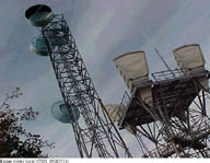
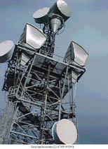
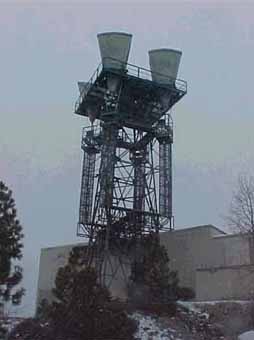
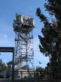
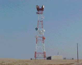
ALISIAL HILL
(Photo American Tower Corp)
Alisial Hill:
Type: Repeater TD-2
Location: Along the west side of the Alisial Hills just east of Salinas.
Paths: Loma Prieta and Vaqueros
Notes: Typical repeater type structure but horns have already been removed.
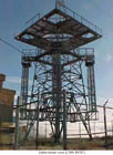
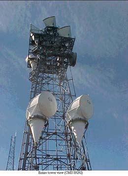
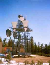
BEAR MOUNTAIN
(Photo American Tower Corp)
Bear Mountain
Type: Repeater
Location: Atop Bear Mountain about 30 miles east of Fresno. Remote
Paths: Rocky Hill and Red Top-Ponderosa
Notes: Part of the western Sierra Nevada Mountain path
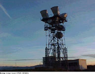
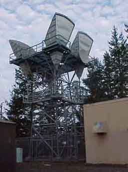
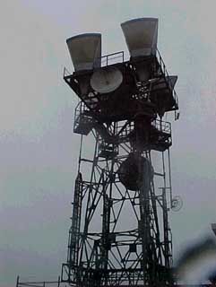
BEAR SPRINGS
(Photo American Tower Corp)
Bear Springs
Type: Repeater
Location: Slope of Bunchgrass Mountain about 8 miles northeast of Montgomery Creek
Paths: Cottonwood and Harlow
Notes:
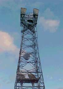
BEN BOLT RIDGE
(Photo American Tower Corp)
Ben Bolt Ridge
Type: Repeater
Location: North end of Ben Bolt Ridge about 3 miles north of Latrobe. Remote
Paths: Union Hill, Sacramento and Lodi
Notes:
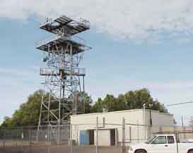
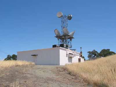
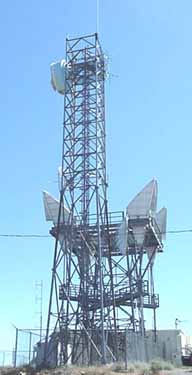
BERNAL HEIGHTS
(Photo Wayne Hayes)
Bernal Heights
Type: Junction/Switched
Location: In the heart of San Francisco
Paths: San Rafael, Oakland, Sierra Morena and Mount Diablo.
Notes: Major junction point for the metropolitan San Francisco
area. Also had cable connections to San Francisco's main tandem
central office (Folsom Street)
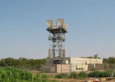
BERRYESSA PEAK
(Photo American Tower Corp)
Type: Junction/Switched
Location: Atop Berryessa Peak about 22 miles west of Woodland. Very Remote
Paths: Dunnigan, Sacramento, Mount Vaca, Red Mountain and Clear Lake.
Notes:
BRUSH MOUNTAIN
(Photo American Tower Corp)
Brush Mountain
Type: Repeater
Location: Just west of Adams Ridge and about 7 miles east of Point Arena. Remote
Paths: Cloverdale and Point Arena
Notes: Served the microwave path to link the long lines cable route to the Point Arena Cable Landing station where AT&T connected to undersea cables going to Japan and Hawaii.
BUENA VISTA
Type: Repeater
Location: Extreme southern end of the San Joaquin Valley by Maricopa Flat. Remote
Paths: Tehachapi Mountain and Temblor Range.
Notes: For more pictures see :Buena Vista
BURDELL MOUNTAIN
(Photo American Tower Corp)
Type: Junction/Switched
Location: Atop Burdell Mountain about 2 miles north of Novato.
Paths: Oakland CO, Santa Rosa CO and Three Peaks (Satellite Earth Station).
Notes:
CEDAR RIDGE (SONORA)
(Photo American Tower Corp)
Type: Repeater
Location:
Paths: Fremont Peak, Angels Peak and Jackson
Notes:
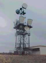
CHICO RADIO
(Photo DukeofURL1 from Chico)
Type: Repeater
Location: In the City of Chico at 1206 W. 8th Ave.
Paths: High Plateau and Tuscan Butte.
Notes: Although not a true junction or switched station this site had a branch on the Dunnigan-Redding L-3 Cable.
CISCO BUTTE
(Photo American Tower Corp)
Type: Repeater
Location: On the south flank of Cisco Butte about 20 miles west of Truckee. Remote
Paths: Wolf Creek and Mount Rose (Nevada)
Notes: At 6,400 feet in the heart of the Sierra Nevada Mountains
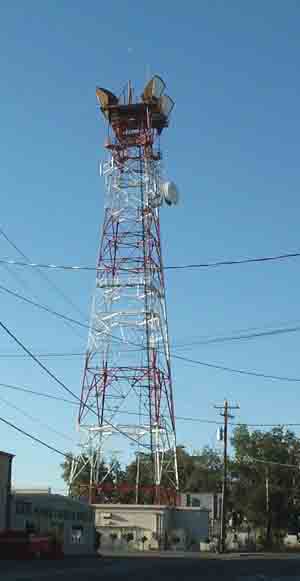
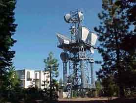
CLAYTON
(Photo Wayne Hayes)
Type: Repeater
Location:
Paths: Lodi and Round Top
Notes:
COTTONWOOD
(Photo American Tower Corp)
Type: Repeater
Location: Along a remote ridgeline about 7 miles east of Cottonwood.
Paths: Paskenda, Redding and Bear Springs.
Notes:
DUNNIGAN
Type: Junction/Switched
Location: Dunnigan, just off the I-5 freeway
Paths: Berryesa Peak
Notes: See more info/photos: Dunnigan
EAST BAY HILLS
(Photo Wayne Hayes)
Type: Repeater
Location:
Paths: Vaca Hill, Mount Diablo, Hayward, Oakland and San Francisco.
Notes:
ECHO SUMMIT
(Photo American Tower Corp)
Type: Repeater
Location: Atop Echo Summit in the Sierra Nevada Mountains about 10 miles southwest of South Lake Tahoe
Paths: Topaz Lake (Nevada), Union Hill and South Lake Tahoe
Notes:
ELK CREEK
(Photo American Tower Corp)
Type: Repeater
Location: Atop Gravelly Ridge about 6 miles southwest of Elk Creek. Remote
Paths: Paskenda and Clear Lake
Notes:
ELK GROVE
(Photo American Tower Corp)
Type: Repeater
Location: About 2 miles southwest of Elk Grove in the Sacramento Valley.
Paths: Lodi and Sacramento CO.
Notes:
FARMINGTON
(Photo American Tower Corp)
Type: Repeater
Location: About 3 miles northeast of Farmington in the eastern San Joaquin Valley.
Paths: Patterson, Lodi, Stockton and Angels Peak.
Notes:
FREMONT PEAK
(Photo American Tower Corp)
Type: Repeater
Location: Atop Fremont Peak, just southeast of Bear Valley
Paths: Cedar Ridge and Red Top (Ponderosa)
Notes: Part of the "Sierra Nevada" microwave route
GUSTINE
(Photo Wayne Hayes)
Type: Repeater
Location: Western Merced County about 5 miles southwest of Gustine.
Paths: Mount Oso and Panoche Mountain.
Notes: Located amongst the California "Salad Bowl". Site surrounded by vegetable farms.
HARLOW
(Photo American Tower Corp)
Type: Repeater
Location: Just north of Pondosa in northern California. Remote
Paths: Bear Springs and Timber Mountain
Notes: This site was originally known as Pondosa.
HIGH PLATEAU
(Photo American Tower Corp)
Type: Junction/Switched
Location: Atop High Prairie Ridge in Yuba County, about 20 miles northeast of Yuba City. Remote
Paths: Wolf Creek, Pleasant Grove and Chico.
Notes:
JOAQUIN RIDGE
(Photo American Tower Corp)
Type: Junction/Switched
Location: Atop Black Mountain along Joaquin Ridge about 12 miles north of Coalinga.
Paths: Fresno, Pyramid Hills and Panoche Mountian
Notes:
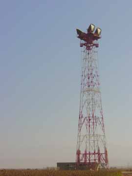
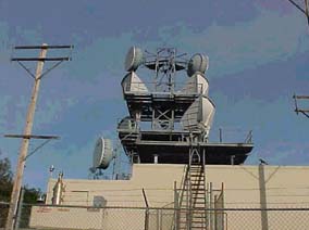
LODI
LODI COMPOUND
(Photos Chad Perkins)
Type: Switched/Junction
Location: Just west of the City of Lodi
Paths: Jackson, Pennington, Collegeville, Stockton, Clayton, Ben Bolt Ridge and Elk Grove
Notes: Major junction point in the northern California system and a large AT&T facility (like Newhall). Had L-3 cables running to Stockton and Sacramento. Today junction point for F/O from Stockton, Sacramento and Gilroy